It’s quite different from the modern, westernized resorts you may be accustomed to skiing. When you Ski Gulmarg, expect a larger percentage of backcountry areas that are not controlled where you ski and snowboard at your own risk – and the opportunity for more adventure and endless lines of untracked powder!
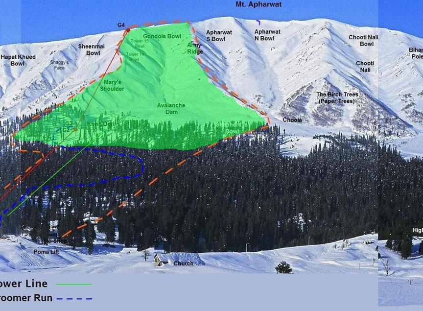
Gulmarg - The controlled ski area trail map
Trail Map of Gulmarg Ski Resort highlights all of the in-bound skiing options within the controlled ski area. The yellow dotted line indicates the controlled in-bound ski area boundary. In-bound ski options include some groomed runs (not groomed on a regular basis), tree skiing, and one bowl - Gondola Bowl (Mary’s Shoulder).
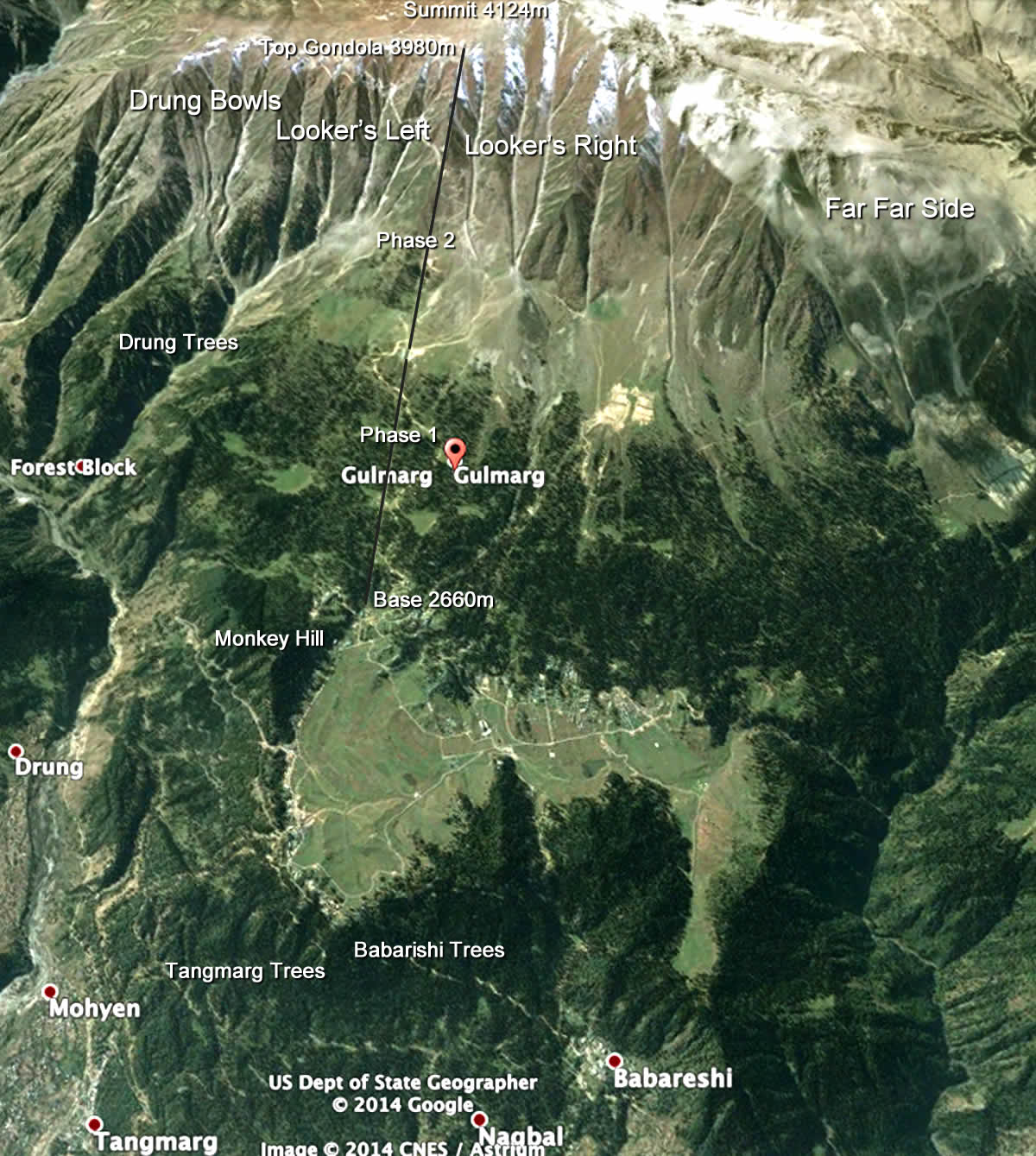
Gulmarg – Satellite Images (Ski Trail Map)
Satellite Map showing an aerial view of Gulmarg Ski Resort, Gulmarg Village, Mt. Apharwat Summit, and surrounding areas.
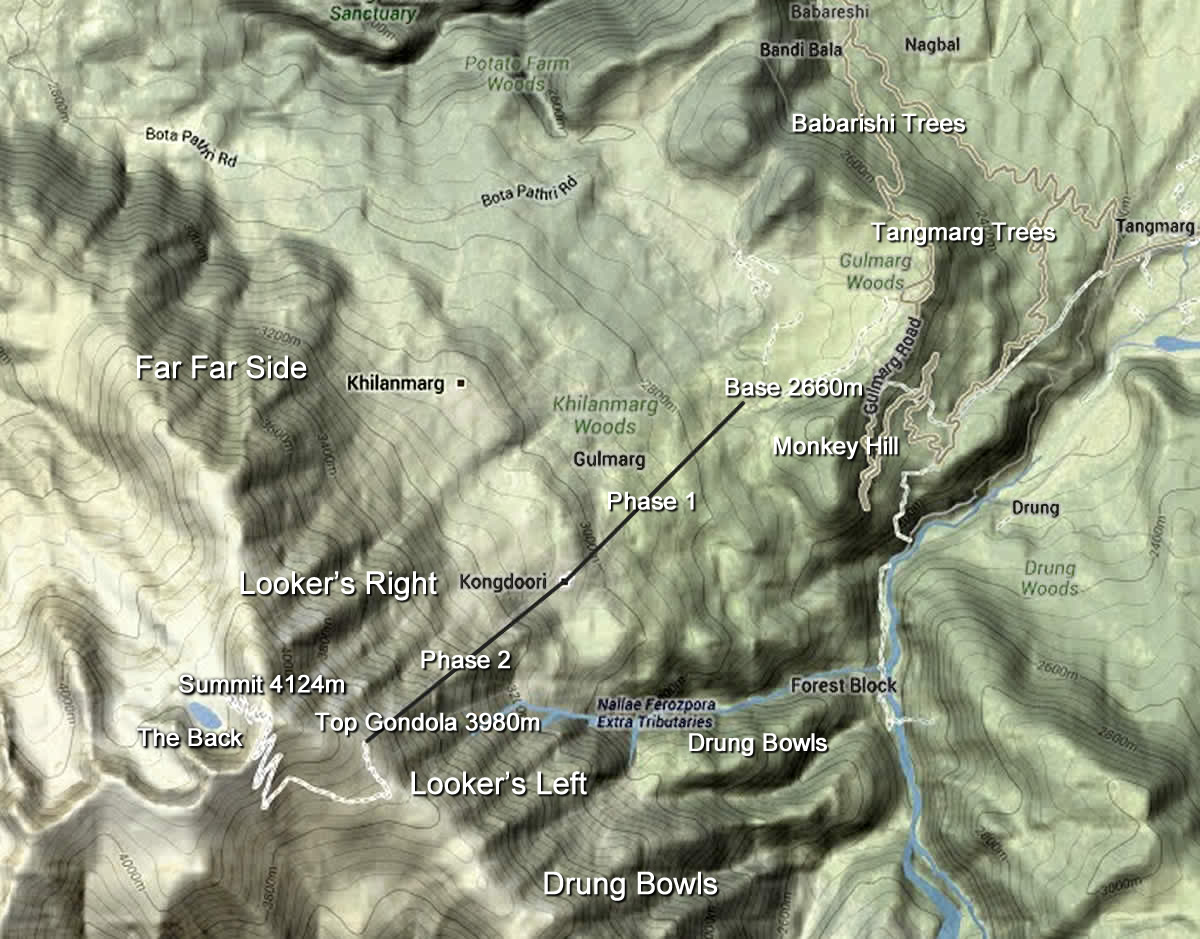
Gulmarg – Topographic Map (Ski Trail Map)
Topographic Map of Gulmarg Ski Resort, Gulmarg Village, Mt. Apharwat Summit, and surrounding areas.